Thursday 25 June 2009

Things that DO suck


  1. Sadistic Flight Instructors

  2. Flat batteries in your Camera


Trevor managed to get yesterday off work, and the fine weather was still hanging in there, so we decided to finish the dual flight that we had aborted on Sunday due to the vacuum pump failure.

AR-(AP)-(MA)-TG, Divert (TH)-AR

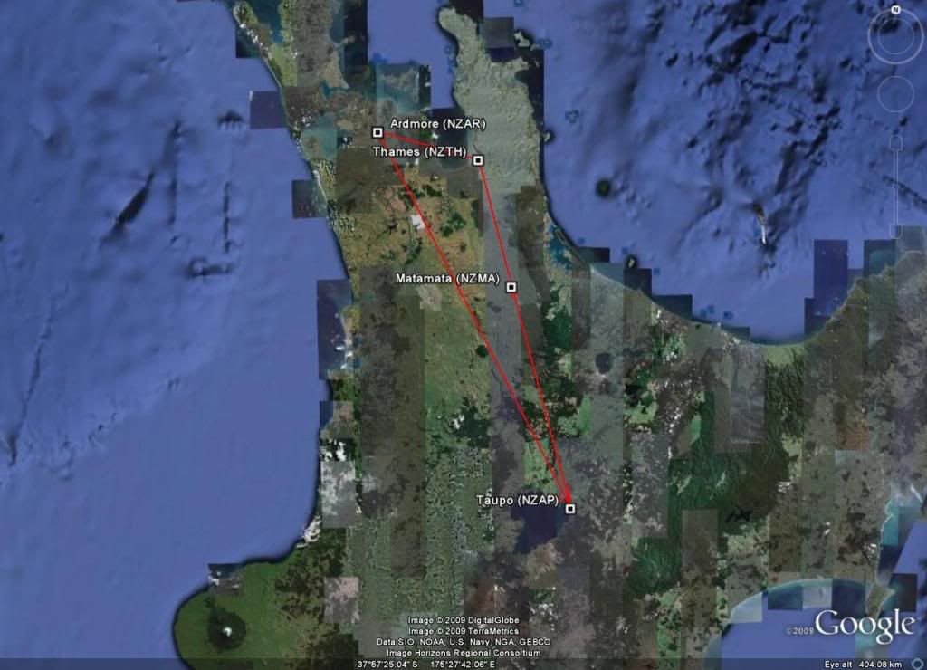
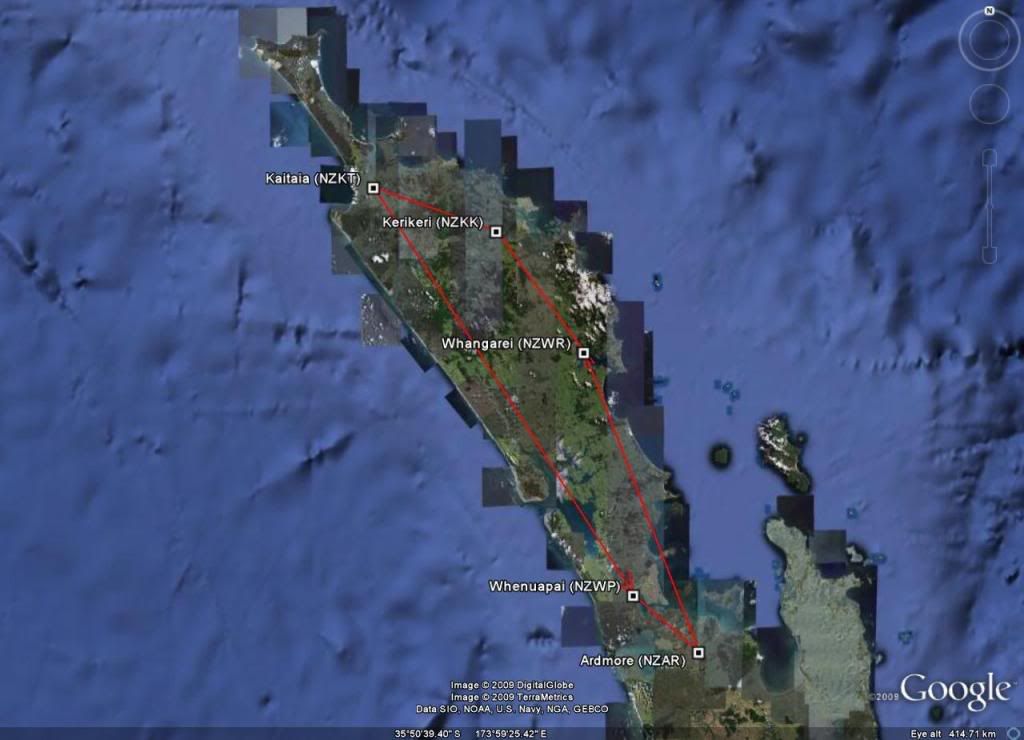
The "plan" was to fly Ardmore (NZAR) - Taupo (NZAP) - Matamata (NZMA) - Tauranga (NZTG) - Ardmore (NZAR). But as I have discovered with dual CPL cross countries, what you plan and what you fly are two very different things :P

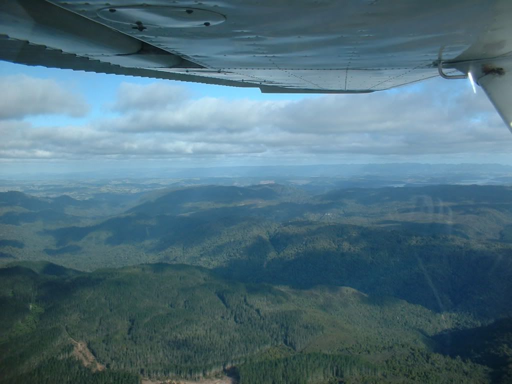
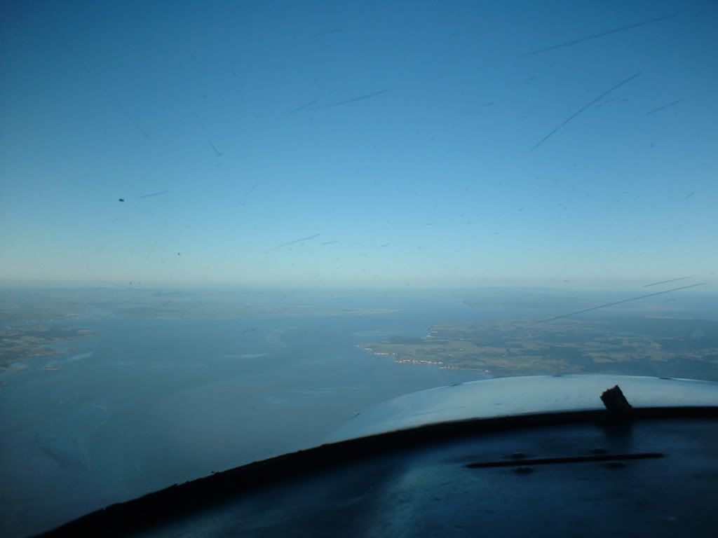
The trip to Taupo was pretty good. The winds were 'lightish' so the flying conditions were relatively smooth and the visibility was excellent. We could actually see Mt. Ruapehu while overhead Drury, which is a distance of about 250km!!!

I was really looking forward to getting some good photos of the mountains and Lake Taupo, until I handed my camera to Trevor and asked him to take some photos and he discovered that the batteries in the camera, which had been working perfectly in the morning, were now completely flat :( As I was too busy flying the aircraft and trying to do ground speed checks, plan my top of decent, look out for other aircraft and make radio calls, I couldn't be bothered trying to dig my cellphone out of my flight bag to try to get some pics on that...

I think I know what I want for my BDay/Christmas now... a nice little 'point and shoot' digital camera with a battery life longer than about 3 minutes :P

Anyway, we stopped in Taupo, gassed up, I had a bite to eat and visited the little boys room while Trevor checked out a car he is thinking of buying. Then we headed off into the clear blue skies and bade farewell to the snowy capped mountains and silky smooth lake and headed for Matamata.

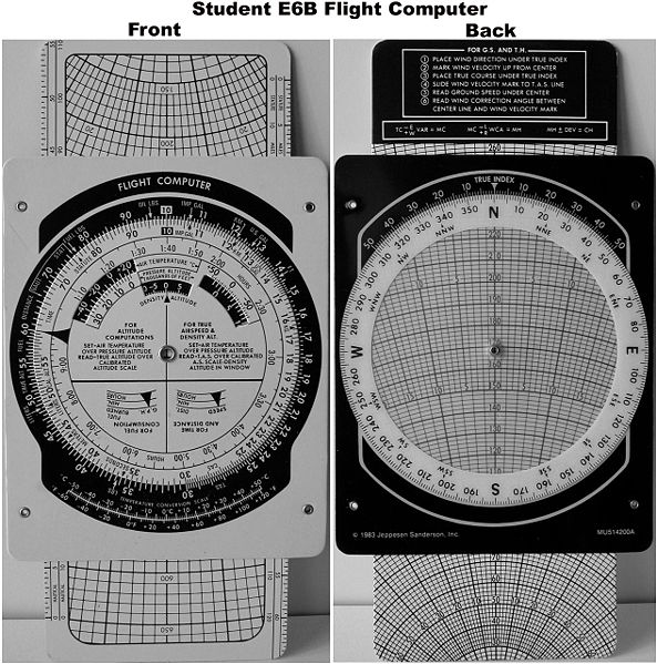
After deciding I was a little bit off course, Trevor decided I should do a "1 in 60" to get to Matamata. Effectively you work out "Distance Off course divided by Distance Flown" and "Distance Off Course divided by Distance to Go". The first gives you the track error so far (usually a result of the wind not being what was forecast), and if you correct by that much you will end up paralleling your original track, but you will still be off course. In my case 2 nm miles off course after 25 miles flying or ~4 degrees. The 2nd calculation gives you the closing angle to arrive at your intended destination, so I needed to correct 2nm over the remaing 37 miles to Matamata (~3 degrees), resulting in a total correction of 4+3 or 7 degrees.

Now if it all sounds a bit like hard work trying to divide all sorts of random numbers in your head... you are right! That's why we use an "E-6B Flight Computer"... basically a fancy circular slide rule that makes a lot of aviation related calculations really easy ;)

The E-6B "Whizzwheel"

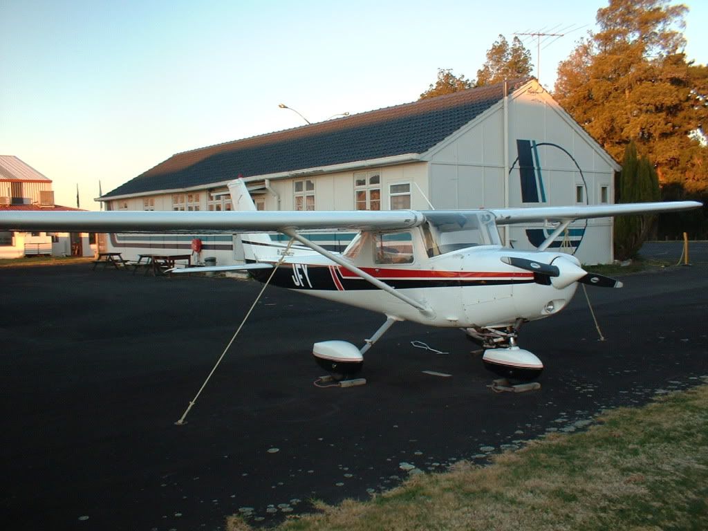
The "1 in 60" worked out pretty good, and I ended up pretty close (less than 1 mile) from Matamata. We dodged our way around the gliders, tanked up with gas and made ready to depart. At which point I learned that a 152, with 2 people on board and full tanks doesn't really depart that well from a runway consisting of relatively long grass! Even with shortfield technique we burned an awful lot of runway, but made it into the air eventually and with plenty of room to spare.

I was just commenting to Trevor that it was an awfully long take-off roll when he pulled the throttle 1/2 closed and called simulating. Lower the nose, Carb Heat On, Throttle Closed, Pick a paddock, Fuel/Mixture/Ignition Off. I hadn't seen the Engine Failure after take-off coming!!

He was satisified with my choice of paddock and we would have made it quite comfortably, so he called go-around and we climbed away on track to Tauranga. I had just got up to 2500' feet and managed to get Christchurch Info on the radio and pushed my SARTIME out when Trevor looked at me with a big grin and "Did I say Tauranga?? Oh, I meant Thames... oh and look at all that crappy weather (Clear Blue skies, visibility of around 60km :-/), ceiling is now 1500'"... So I started my diversion to Thames.

Due to the "crappy weather", I ended up with a ceiling of 800', so I was low (and slow) flying at 700' at 70knots. I called up CH Info and amended my flight plan and started heading for Thames. Eventually, "the weather" cleared and I was allowed to climb back up to 2500'. Just as I got there, and had everything sorted out and was planning my approach into Thames, Trevor pulled the throttle and said simulating.... AARRGGGHHH!!!

I was a bit rusty on the procedure for the forced landing, but I picked my paddock, planned an approach and would have put it in without too much trouble.

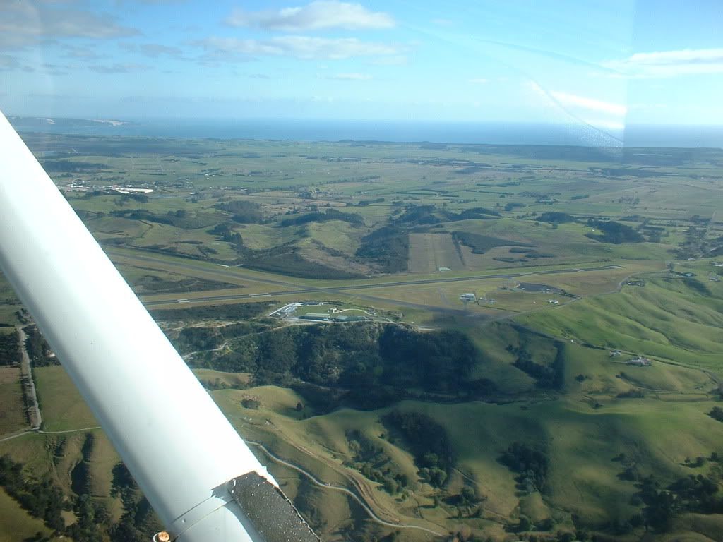
The nice long runway (14/32) at Thames is currently closed for maintenance, so I had the really short 500m runway (05/23) with a lovely approach for runway 23 that takes you quite close to some seriously high ground. I flew a really nice shortfield approach, touching down right on the threshold at minimal speed and blasted off again with plenty of room to spare. :D

I set heading for Ardmore and as usually seems to be the case, ended up arriving at the same time as everyone else :( I was just coming up to Hunua at 2000' and was about to report my position and intentions, when no less than 3 other aircraft all reported claiming to be exactly where I was! :-O I could only see one other aircraft and he was about 5 miles away!!!

I decided to stay out of the mix and gave everyone plenty of room and I slotted myself into a gap in the circuit traffic and landed without too much bother.

I was quite happy to be back on the ground after such an 'eventful' flight... and I definitely need to go and do some forced landing procedure revision before my cross-country flight test!


This Flight: 3.7 Dual (242 nm)
Total Hours: 209.0 (91.9/92.8 Day, 8.6/15.7 Night, 7.2 IFR)

Tuesday 23 June 2009

Things that don't suck...


  1. Broken Vacuum Pumps

  2. Getting released from Jury Service on the first morning

  3. Large High Pressure weather systems covering the country in blue skies and sunshine

On Sunday, I had been planning a dual cross country with Trevor. Everything was looking good until about 1/2 an hour into the flight. We were overhead Lake Waikere, about 5 miles east of Huntly and noticed that the AH had fallen over. Thats when I noticed the Suction Gauge was reading right off the top end of the meter. Just as I said to Trevor "I wonder how long until the DI plays up?", The DI started doing it's best impression of a roulette wheel. Technically, an AH and a DI are not required for VFR flight, but seeing as we were so close to home, I decided to abort the flight and returned to Ardmore.

Monday, was the beginning of Jury Service... I was actually kind of keen (read as: curious) to go along and see what it was all about. So I headed down to the courthouse on Monday and sat in a room with about 100 or so others (most of whom were just interested in when they could go home).

After an hour or so, they did the 'lottery' and called up a whole bunch of people and sent them off to the various courtrooms... The rest of us sat around for another hour or so at which point they did another lottery for a trial that was due to start on Wednesday and then told everyone else they could go...

Seeing as how I had already arranged for most of the week off and the weather for the next couple of days was looking pretty good, I called my boss and asked if I could have Tuesday and Wednesday as annual leave.

So instead of debating guilt or innocence, I spent the week flying :)

Trevor was unable to get Tuesday off work, so I headed off for another Solo cross country. This time, I headed up North, hoping it might be a little warmer up there... I was wrong :(

Cold, frosty start

AR - WR - KK - KT - o/h WP - AR

I had planned for Ardmore (NZAR) - Whangarei (NZWR) - Kerikeri (NZKK) - Kaitaia (NZKT) - Ardmore (NZAR). The winds were a bit shifty at Whangarei, and even with full flap and power at idle, I was only descending at about 100' per minute! The end result was that I ended up high and executed a go-around. The next approach was much better and I got in with no trouble. I taxied back to the holding point and departed for Kerikeri. It was as quiet as always at Kerikeri, so I filled up with avgas, paid my landing fee in the Honesty Box and headed for Kaitaia.

Welcome to the Bay of Islands!

Tiger Country!

I noted on arrival in Kaitaia that the aircraft seemed to be burning a lot more fuel that it should be... I filled up again and made a mental note to check this with Chris when I got back to Ardmore. As it turns out, the dipstick was calibrated incorrectly (it was under-reading by about 5 litres), so I actually had more fuel than I thought.

Kaitaia Airport

Kaipara Harbour at 4500', Nice and smooth but hazy

Following a suggestion that Chris had made before I left, after departing Kaitaia, I amended my flightplan to fly down the Kaipara Harbour and overhead the airforce base at Whenuapai (NZWP) and cut across their control zone back to the city. Some new airspace for me, and a slightly different perspective of the Harbour Bridge and CBD :)

Cleared to overfly the tower, 2500' VFR, Juliet Foxtrot Yankee

Approaching the Harbour Bridge from the west

Overhead the Harbour Bridge - Awesome weather

The rest of the trip was fairly uneventful. Ardmore was actually pretty quiet for a change. Usually about 10 aircraft all arrive at the same time that I do! I secured the aircraft and went to have a well earned beer ;)

The trusty steed - JFY


Flights: 1.0 Dual + 4.3 Solo (295 nm)
Total Hours: 205.3 (88.2/92.8 Day, 8.6/15.7 Night, 7.2 IFR)

Saturday 20 June 2009

Upstairs, Downstairs

The atmosphere is truly a strange and bizarre place...

Take today for instance, downstairs on the ground it was light and variable winds, while upstairs at 2000' it was 30+ knots!!

I was somewhat apprehensive, given some of the forecasts were for 45 to 50knots, and some of the terrain on my planned route was "less than flat" ;) But given that the skies were clear and this is CPL level you cannot let a little bit of wind stop you!

I had flight planned for Ardmore (NZAR) - Tauranga (NZTG) - Taumarunui (NZTM) - Raglan (NZRA) - Ardmore (NZAR), a nice little 265 nautical mile route that was a bit of a mix of new and old.

The flight out to Tauranga was fairly uneventful and relatively smooth until crossing the Coromandel Ranges where, as expected, the southerly winds were generating some turbulence. I met a student from CTC, also on a solo cross country, at the fuel pumps and we traded some small talk about the cold weather and how annoying leaky cabin air vents are when you're trying to keep warm at 3500'! ;)

Clear and smooth

I tanked up just in case there was no fuel at Taumarunui and made ready for departure. Despite there being a quite a few arrivals and departures, everything was flowing pretty well so I didn't have much of a wait and was cleared ontrack to Taumarunui (yay, no complicated departure procedure).

The leg to Taumarunui was a little more interesting than the first one to Tauranga. At one point I swear JFY was moving left, up, right and down all at the same time! The lenticular cloud forming over the central mountains was a fairly good indication that the forecast winds had indeed arrived... as was the concrete mixer like flying conditions! :-/

The terrain was also more 'interesting'... a series of deep gullies with very steep sides and large sections of almost perfectly flat land between. As opposed to the normal 'rough' terrain that appears to be sharp ridges rising up, this looked like large areas of earth had been scooped out.

A great shot, ruined by turbulence dropping a wing

NZ's answer to the Grand Canyon?

After topping off the tanks again, I finally had a chance to pickup a tail wind as I set course for Raglan. While it made the groundspeed faster, it didn't help all that much with the turbulence ;) Still, the views were kinda cool...

There was a small airforce at Raglan... several Cessna 185 tail draggers, a Cherokee 140, a Fletcher, a Cessna 206 Stationair and a Hughes Helicopter. An RV 'homebuilt' and another Cherokee arrived shortly after I landed. I just hoping everyone wandered over to the camp ground office and paid their $5 landing fee like I did!

Busy busy at Raglan

And then back home... in somewhat record time. I had flightplanned 21 minutes flying at something like 135 knots groundspeed. I had landed, taxiied back to the Airline Flying Club apron and shutdown in 20!!! :-o

In other news, I have reached (exactly) 200 hours total time! :D

CPL here I come...


This Flight: 3.8 Dual (265 nm)
Total Hours: 200.0 (87.2/88.5 Day, 8.6/15.7 Night, 7.2 IFR)

Monday 8 June 2009

An expensive week...

I think that must be the most money I have spent on aviation in one week that didn't involve international air travel!!

After the first 2 CPL cross countries, I decided that a 3rd seemed like a good idea :-/

Originally, the intent had been to have CFI Rob as PinC again, with Trevor in the back getting a bit of a "live" refresher on CPL Cross Countries, so I could finish off the syllabus with him. We had a spare seat, so invited one of Trevor's PPL students along so she could get some practise at map-reading, navigating and the use of AIP aerodrome charts etc.

Unfortunately, about 15 minutes prior to our planned departure, Rob decided he was not feeling to flash (turns out he had an ear infection), so decided that Trevor would conduct the flight. They disappeared into a briefing room to plot all manner of evil schemes for the flight, while I filed the flightplan.

The planned flight was Ardmore (NZAR) - Kaikohe (NZKO) - Kerikeri (NZKK) - Whangarei (NZWR) - Ardmore (NZAR), but being a CPL cross-country, I was expecting diversions, so I made sure I had the AIP plates for the surrounding airfields like Dargaville, Kaitaia & North Shore handy. As it turned out, the 'surprise' exercise for the day was instrument flying... I had not done any IFR flying for a looooong time, October 2008, so I was a little alarmed when flying the first leg Trevor turned around and retrieved the instrument hood from the back seat and handed it to me :( I had not even seen him put the hood in the aircraft, so it was something of a shock.

Anyway, I managed to keep the aircraft the right way (shiny side) up, and pointing in the general direction that I was instructed to, and managed to hold my altitude fairly well despite the lumpy conditions. After about 10 to 15 minutes, Trevor told me to take the hood off, which I was really thankful for... until he asked me where we were!!

I had figured we were flying for a little of 10 minutes, and roughly knew the direction we had been heading in, so had a vague idea... but trying to pinpoint your location is a real exercise. Thankfully, the 'Far North' is a relatively 'thin' piece of land, so there is not too many places to go... there is also the enormous Kaipara Harbour to help pinpoint your position. I was trying to using railroads, transmission lines and tunnels to help pinpoint where I was. As it turns out, we were a long way off track and it actually took me a couple of goes to figure out exactly where I was... but I soon had it nailed down and we proceeded to Kaikohe without any further problems... until all the wind disappeared as I was crossing the threshold and the cherokee decided it didn't want to fly anymore :-/ Exciting stuff... not!

We tanked up with gas, triple-checking the fuel drains as I don't trust the watertightness of these 'out of the way' airfields that don't get a lot of fuel turnover. I dropped some coins in the honesty box to cover the landing fees and with everything in order we headed to Kerikeri and I got a lesson in time management. The leg is quite short... only about 10 or 12 miles and we had a 20 to 25knot tail wind... making it a planned leg of around 7 minutes! Pro-tip: Listen out on the destination frequency and see if you can get an idea of traffic and runway in use before you depart!

I joined overhead, established wind direction and best runway to use, landed, back-tracked and departed for Whangarei. After dodging a Beech 1900D and a much better approach and landing, we headed to the Terminal Building to enjoy a bite to eat... only to discover the cafe was closed while the owner had gone to pick up her son! We waited around for about half an hour or so and they returned and I finally got to enjoy the 'Double Happy' (double sized sausage roll) that I had been looking forward to all day!

Fed and watered, we all climbed back in and departed for home. The final leg becoming a lesson in weather avoidance as we "dodged, ducked, dipped, dived and dodged" rain showers on the trip south. As I had discovered on my trip to hamilton a few weeks ago... making sure you have an escape route is a really good idea. Thankfully, I didn't need to use any of them, as most of the large patches of weather were just that, patches... so we were able to fly around, between and under them.

There were lots of backup plans, like Omaha Flats airstrip, Spring Hill, Kaipara Flats and North Shore available should anything really bad come our way, but soon enough the Whangaparoa Peninsular and Auckland City came into view and we could see the weather was, not necessarily nice but clear...

So we ducked down to 1000' to use the VFR transit lane through Whenuapai's airspace and VFR'd our way back through the harbour area to Ardmore.

Plenty to talk about in the debrief, with lots of really useful tips from Trevor which I have filed away for future reference.

So I am now about 1/2 way through the CPL Cross Country Syllabus... and about 3/4 way through the available credit on my credit card!!! :-O


This Flight: 3.7 Dual (241 nm, 0.2 IFR)
Total Hours: 196.2 (87.2/84.7 Day, 8.6/15.7 Night, 7.2 IFR)

Friday 5 June 2009

On the clock...

I've taken the plunge and commenced my CPL Cross Country training... I have 12 months to finish it off. Tick Tock... Tick Tock.

Rather than wait for the good weather and a weekend to arrive at the same time, I caught myself a bad case of 'Midweek Altitude Sickness'... Twice! ;) 9 hours over 2 days...

Wednesday and Thursday were ideal VFR flying conditions. A big fat high sitting over the country (Pressure was 1033 over the entire country on Wed!), with clear blue skies and temperatures in single digits.

I went flying with CFI Rob on Wednesday, with the route Ardmore (NZAR) - New Plymouth (NZNP) - Taumarunui (NZTM) - Ardmore (NZAR). I was told to expect a diversion in there somewhere. This turned out to be between New Plymouth and Taumarunui... where I was instructed to fly to Ohakune. It is shown on the charts, but not in the AIP. Turns out it is a private strip, owned by CFI Rob's 2nd Cousin, who owns one of the Ski shops in Ohakune.

A very interesting little one-way strip with a curved approach, sitting at 2000' AMSL. Good fun!

I was concentrating on height and heading holding, and over all I think I did a good job. During the debrief Rob said flying-wise there was not too much to be concerned about, but I needed to improve the efficiency of my ground work, as you only get 1 hour once given the route to flight plan and pre-flight. I took about probably about 1hour 10mins... No real drama's, just a little out of practise.

During the flight itself, Rob emphasised the things they were looking for in 'professional' pilots... constantly assessing the situation and always planning ahead. The necessity for this became apparent during the diversion when we flew over some real 'tiger' country. Very rugged with large expanses of forest that would just swallow a light aircraft. Being constantly on the lookout for likely landing spots should an emergency arise, while accurately flying, map-reading, being aware of controlled airspace etc... makes for a very busy pilot ;)

Quite a long day at 4.6 hours of flight time, over 300+nm's distance and a shade over 6 hours of 'real' time (7 if you include the groundwork).

During the debrief, he asked when I would be interested in doing a solo flight. I told him I already had the aircraft booked for the following day!

So on Thursday, I got up and did it all over again... only on my own and without the diversion. I decided on another 300+nm flight, as it is a requirement for a C-Cat, so will help out later on. Rob (and Trevor) suggested Gisborne, and while it sounded like fun, I didn't fancy spending 2+ hrs flying back on a westerly heading directly into the sun. So, I flight planned for Ardmore (NZAR) - Whakatane (NZWK) - Opotiki (NZOP) - Taupo (NZAP) - Raglan (NZRA) - Ardmore (NZAR), which is just over 320nms. I checked the weather, and it looked like I was going to fly a large circle around a huge patch of fog covering most of the Waikato and north of the Central Plateau. Which, as you can see from the pics below, I did!

I ended up delayed a little, due to the severe ice buildup on the aircraft overnight and a minor "technical difficulty" (read as: Engineers taking aircraft for a compass swing), but other than that it was a great day.

Please excuse the photo-quality, I was sure I'd be too busy flying the aircraft to be fluffing about taking photos, so I didn't bother taking a camera. However, the views were just too good not too, so they're off my cellphone. They really don't do do justice to the stunning sights to be had around our country!

Overhead the southern end of the Hunua Valley, looking south towards Lake Waikare and Huntly.


Tauranga and the Mount... looking pleasant as always


Whakatane was it's usual deserted self... and despite the "Variable 5knots" winds, it still managed a nice crosswind :). I soon, after about 5 minutes of looking, discovered that they've moved the landing fee honesty box. It's now tucked away in the airside entrance to the terminal building.

Opotiki was much nicer than my previous visit. And my approach and landing was about a million times better!

The 'Cloud Factories' north of Taupo


Taupo was busy with helicopters in the circuit, about 3 different sky-diving operations running and various transient aircraft. I thought about stopping here for lunch, but parking space was at a bit of a premium, so I decided to head off after a quick snack (mmmm One Square Meal).

Not going anywhere in a hurry


Notice the fog to the left, clear to the right


Picture Postcard Perfect


Raglan was quiet. REALLY quiet. But the locals are very friendly and after paying my landing fee at the camp office, I asked if there was anywhere close by that I could get a bite to eat and a drink as I needed a break after being couped up in a 152 for 4 hours. The office lady suggested the camp store. So I called the National Briefing Office and added an hour to my SARTIME and went for a look.

Pro-tip of the Day: The camp store at Raglan makes great fish and chips ;)

It was perfect afternoon... blue sky, sunshine, great food and a cold drink...

I thanked the ladies at the store and headed back to the airfield before departing for home, once the people walking their dog across the airstrip were safely out of the way! :-/

Glad I decided against that return trip directly into the sun...


All up, 4.4 Hours flight time and 320+nm's... Much better than sitting at my desk :P Must remember to thank my (very understanding) boss!


Flights: 4.6 Dual (334 nm) + 4.4 PinC Night (326 nm)
Total Hours: 192.5 (83.5/84.7 Day, 8.6/15.7 Night, 7.0 IFR)